Rockfall Evaluation Using Ninyo & Moore Drone Service
Create 3D Models to Examine Inaccessible Structures
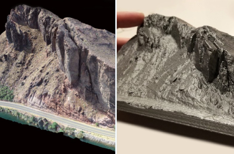
Ninyo & Moore provided geological and geotechnical services to provide a rockfall evaluation for La Paz County. The project area consisted of three steep cliff areas along Riverside Drive in Parker, Arizona. As part of the investigation, a drone survey was conducted to assist in the evaluation of the inaccessible and hazardous areas that could not be safely viewed.
The resulting drone survey produced high-resolution imagery of all inaccessible areas, as well as 3D interactive models, that were used for close-up inspection and measurement of areas of concern. Additional point cloud data and contour maps generated from the survey were used in conjunction with geologic unit maps and slope stability analysis to determine the best approach for rockfall mitigation.
